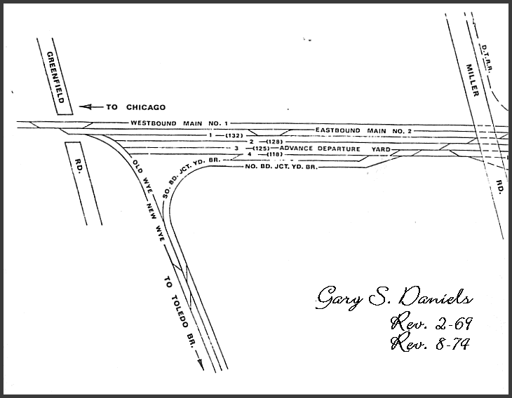
This map was drawn by Gary S. Daniels and published in PC Railroader back in the 1970's. It shows what the location known as CP-Townline looked like in the PC and NYC years. Back then, Junction Yard was a happening deal and we are looking at the west end of it. The top line from right to left is the Michigan Line today. The line heading south is the Junction Yard Secondary today, which terminates at CP-YD on the Detroit Line at River Rouge Yard.